
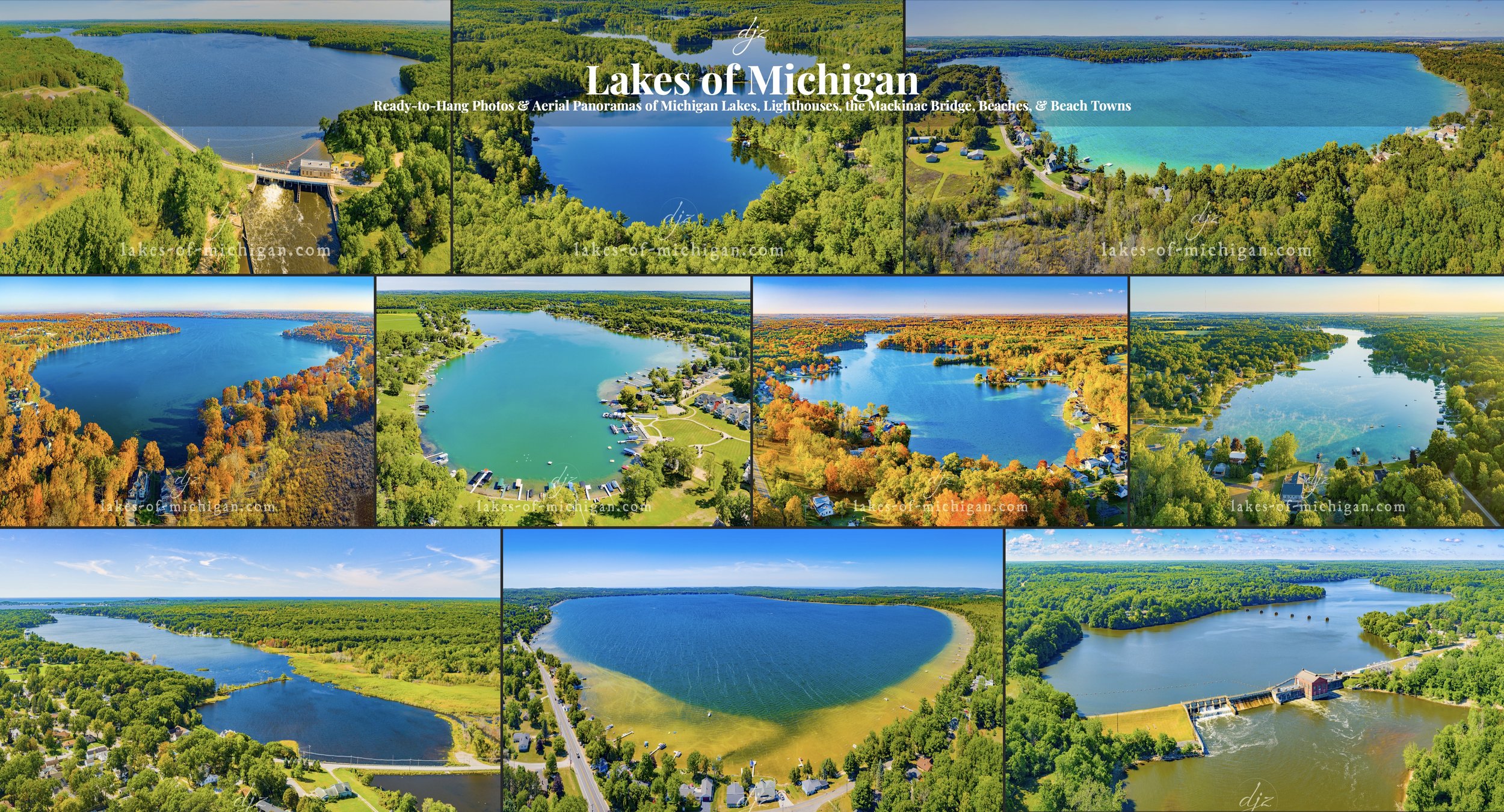
Lakes of Michigan
To search lakes, view all photos locations on a map, view images full screen & purchase prints, visit my other website, Lakes-of-Michigan.com.
Lakes of Michigan Aerial Photos
*Note* - In order to accommodate a very large number of photos in an organized fashion, this page is being replaced by the new Michigan Landscape Photography page. The new page will have many more photos and should make it easier to navigate and search. Thanks, and enjoy!

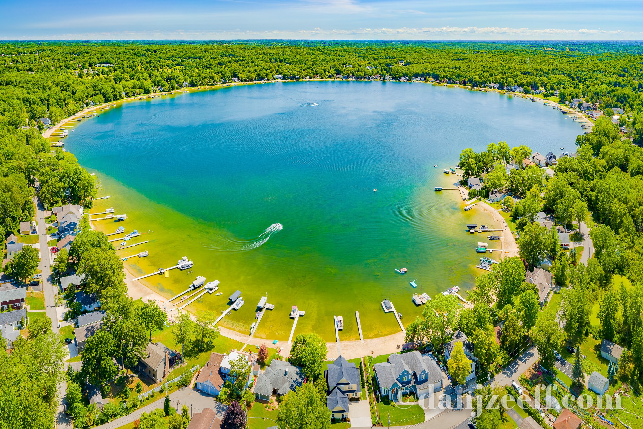
Austin Lake
Austin Lake is near Portage, less than 10 miles South of Kalamazoo in Michigan's lower peninsula. This aerial photo was taken Southeast of the lake in early Fall.

Barlow Lake
East of Wayland and Southwest of Middleville, Barlow Lake is about 20 miles South of Grand Rapids in Michigan's lower peninsula. This aerial photo was taken north of the lake during peak fall foliage colors.

Bear Lake
Located in North Muskegon, Bear Lake opens into Muskegon Lake, allowing boaters to travel between Bear Lake, Muskegon Lake, and Lake Michigan. This aerial photo was taken northeast of the Lake looking towards Muskegon lake, the Muskegon South Pierhead Lighthouse, and Lake Michigan.

Big Pine Island Lake
Located between Belding and Rockford, Big Pine Island Lake is about 16 miles Northeast of Grand Rapids in Kent County in Michigan's lower peninsula. This aerial photo was taken from north of the lake on a summer morning.
Bostwick Lake
Located near Cannonsburg and Rockford, Bostwick Lake is about 13 Miles Northeast of Grand Rapids in Michigan's lower peninsula. This aerial photo was taken from north of the lake on a summer day.

Bowers Harbor
Bowers Harbor is located on Old Mission Peninsula on the West Arm of Grand Traverse Bay, about 10 miles North of Traverse City. This aerial photo was taken northeast of the harbor on a summer day.

Burt Lake
Burt Lake is located near Indian River, south of Cheboygan and east of Petoskey at the north end of Michigan's lower peninsula. This aerial photo was taken southeast of the lake on an early fall evening.
Canadian Lakes
Canadian Lakes is located about 10 miles southeast of Big Rapids, near the center of Michigan's lower peninsula in Mecosta County. This aerial photo was taken from northeast of the lake in the early fall, just as some fall colors were starting to make their appearance.

Cass Lake
Cass Lake is located southwest of Pontiac in Michigan's lower peninsula, near West Bloomfield Township and Orchard Lake Village. This aerial photo was taken west of the lake in the fall during peak foliage color.

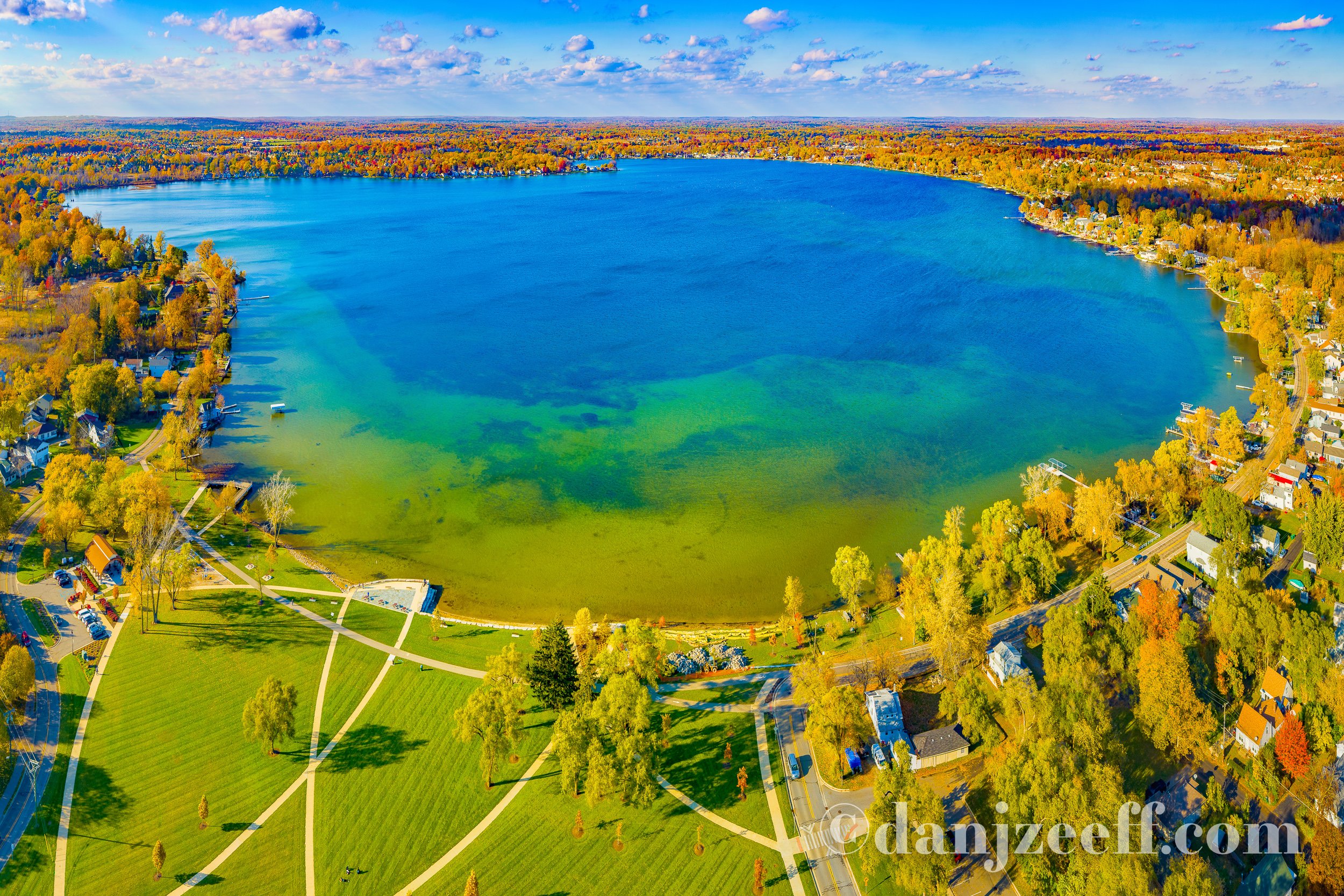
Crystal Lake
Crystal Lake is located near Crystal, about halfway between Alma and Lansing in Michigan's lower peninsula. This aerial photo was taken north of the lake on a summer day.
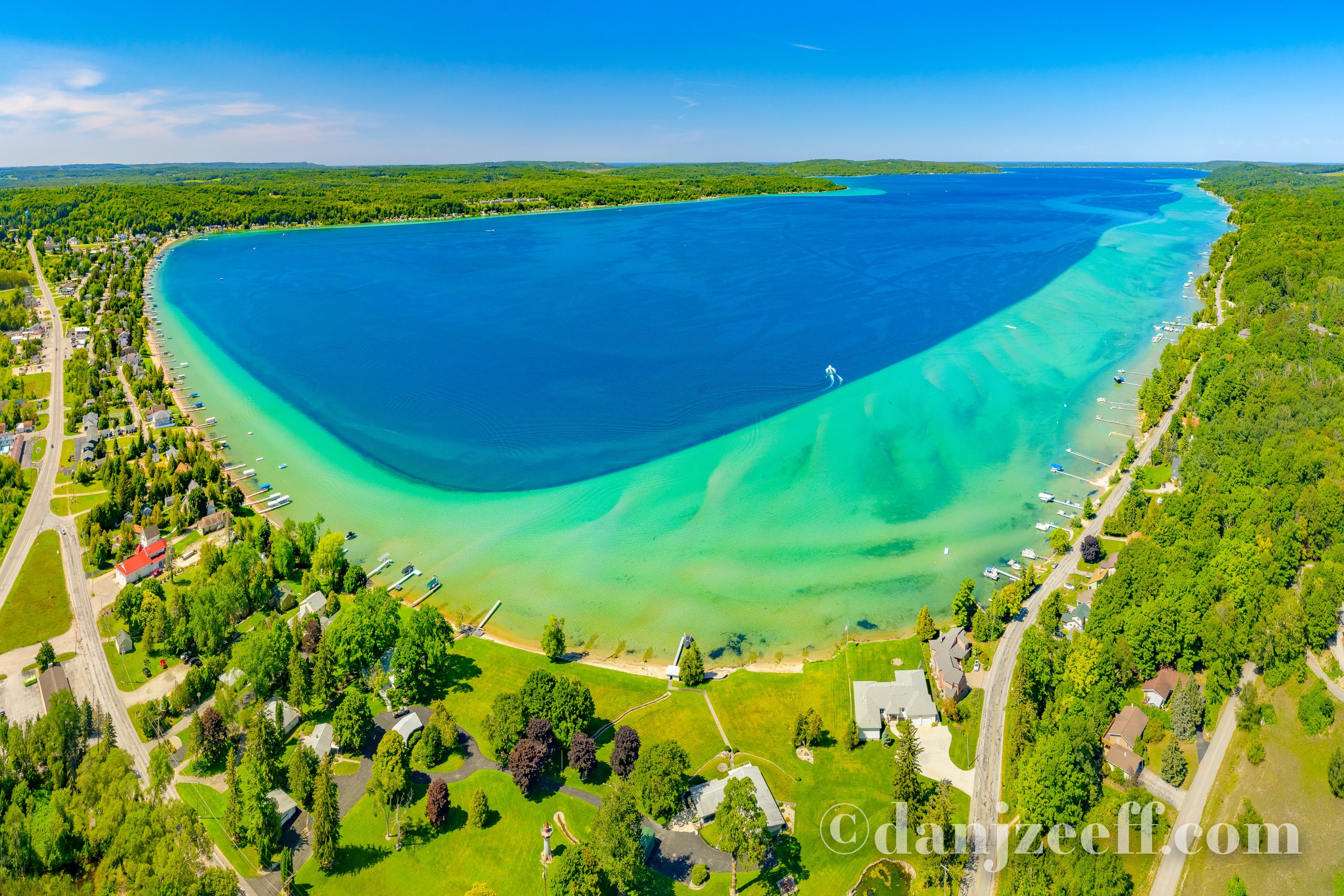
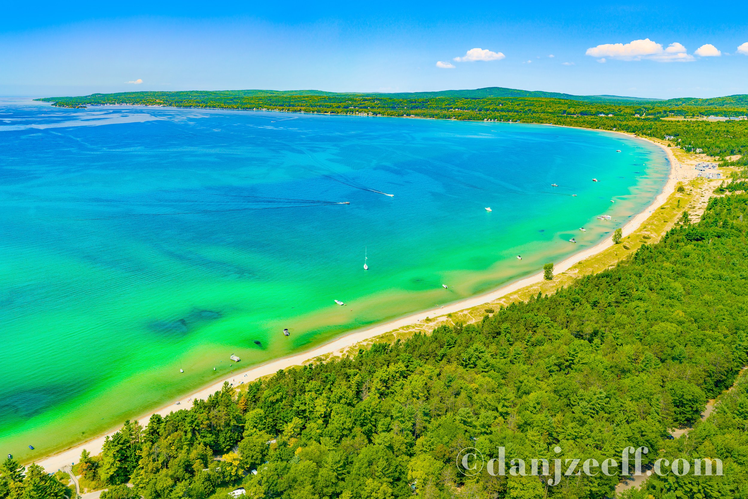
Crystal Lake
Crystal Lake is located in the Northwest region of Michigan's lower peninsula, near Frankfort, Benzonia and Beulah. This aerial photo was taken east of the lake on a summer day, showing a sliver of Lake Michigan in the distance. Love those vivid lines of color highlighting the drop-off!

Diamond Lake
Diamond Lake is located near Cassopolis, west of Three Rivers and Northeast of Niles in the southwest region of Michigan's lower peninsula. This aerial photo was taken west of the lake during peak fall foliage color.

Duncan Lake
Located near Caledonia and Middleville, Duncan Lake is south of Grand Rapids in Michigan's lower peninsula. This aerial photo was taken south of the lake on a summer morning.

Elk Lake
Located near Elk Rapids and Rapid City, Elk Lake is halfway between Traverse City and Bellaire, NW of Kalkaska in Antrim and Grand Traverse Counties in Michigan's lower peninsula. This aerial photo was taken from NNW of the lake on a summer evening.

Fishers Lake
Fishers Lake is located northeast of Three Rivers near Parkville, about 8 miles south of Vicksburg in Michigan's lower peninsula. This aerial photo was taken northeast of the lake in the morning during peak fall foliage color.

Green Lake
Located between Caledonia and Moline, Green Lake is south of Grand Rapids in Michigan's lower peninsula. This aerial photo was taken north of the lake in the summer. The fascinating patterns of sand under the water reminds me of a marble rye.
Gull Lake
Located near Hickory Corners and Richland, Gull Lake is about 10 miles northeast of Kalamazoo and 5 miles south of Delton in Michigan's lower peninsula. This aerial photo was taken northwest of the lake on a summer day.

Gull Lake
Located near Hickory Corners and Richland, Gull Lake is about 10 miles northeast of Kalamazoo and 5 miles south of Delton in Michigan's lower peninsula. This aerial photo was taken southeast of the lake in early fall.

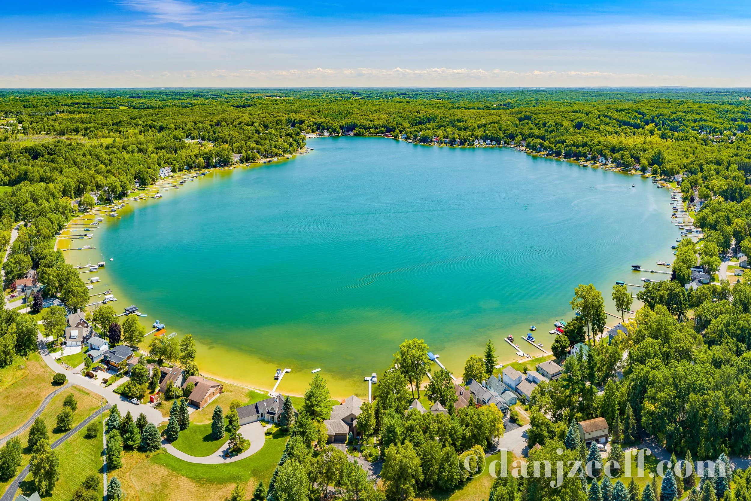
Gun Lake
Gun Lake is located near Wayland, Shelbyville, and Martin, about halfway between Grand Rapids and Kalamazoo in Michigan's lower peninsula. This aerial photo was taken northwest of the lake on a summer morning.

Higgins Lake
Higgins Lake is located near Roscommon, south of Grayling and North of Houghton Lake in Roscommon County in Michigan's lower peninsula. This aerial photo was taken south of the lake on a summer day.

Higgins Lake
Higgins Lake is located near Roscommon, south of Grayling and North of Houghton Lake in Michigan's lower peninsula. This aerial photo was taken north of the lake on a summer day. Check out that transition of color from sand, to turquoise, to dark blue!

Houghton Lake
Houghton Lake is located near Roscommon just south of Higgins Lake, with Grayling to the north. Houghton Lake is the largest inland lake in Michigan as measured by surface area, but not water volume. This aerial photo was taken northwest of the lake on a summer morning.

Kalamazoo Lake
Kalamazoo Lake is located near Saugatuck and Douglas on the southwest shores of Michigan's lower peninsula, connecting the Kalamazoo River to Lake Michigan. This aerial photo was taken southeast of the lake on an evening in early fall.

Klinger Lake
Klinger Lake is located between Sturgis and White Pigeon, about 10 miles southeast of Three Rivers in Michigan's lower peninsula. This aerial photo was taken southwest of the lake on a summer day.

Lake Angelus
Located just north of Pontiac, Lake Angelus is between Auburn Hills & Waterford Township in the southeast region of Michigan's lower peninsula. This aerial photo was taken east of the lake during peak fall foliage color.

Lake Bella Vista
Lake Bella Vista is located between Rockford and Cannonsburg, northeast of Grand Rapids. This aerial photo was taken east of the lake on a summer day.

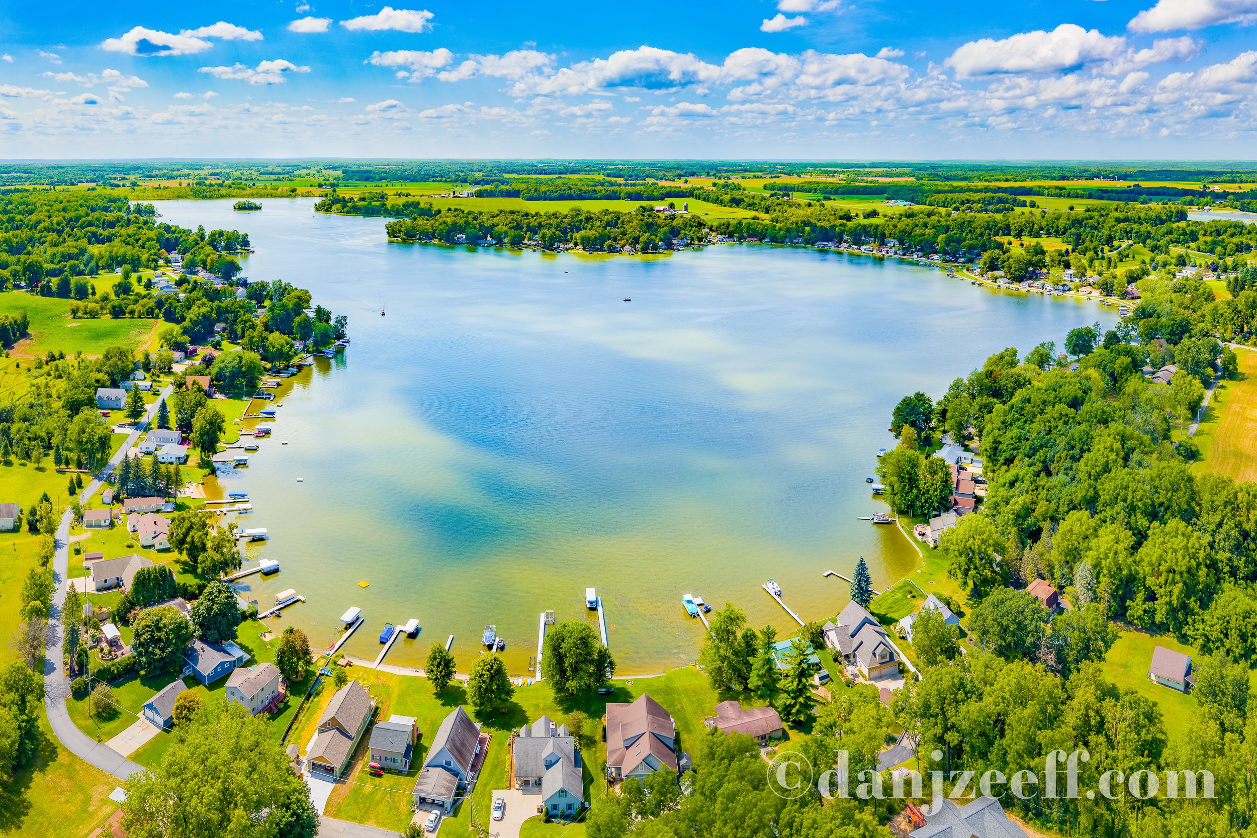
Lake Lansing
Lake Lansing is located near Meridian Charter Township, just east of Lansing in Michigan's lower peninsula. This aerial photo was taken north of the lake on a summer day.

Lake Charlevoix
Lake Charlevoix is located near the northwestern shores of Michigan's lower peninsula, situated between the cities of Charlevoix, Boyne City, and East Jordan. This aerial photo was taken northwest of the lake on a summer day.

Lake Charlevoix
Lake Charlevoix is located near the northwestern shores of Michigan's lower peninsula, situated between the cities of Charlevoix and Boyne City. This aerial photo was taken southeast of the lake on an evening in early fall. Boyne City is partially visible on the right side of the image, where the Boyne River flows into Lake Charlevoix.

Lake Charlevoix
Lake Charlevoix is located near the northwestern shores of Michigan's lower peninsula, situated between the cities of Charlevoix and Boyne City. This aerial photo was taken from northwest of the South Arm on a summer evening as the Ironton Ferry heads west.

Lake Leelanau
Lake Leelanau is located near Leland on the Leelanau Peninsula, northwest of Traverse City, on the northwest shores of Michigan's lower peninsula. This aerial photo was taken southwest of the North Arm on a summer day. Lake Michigan is on the left, with islands visible in the distance.

Lake Leelanau
Lake Leelanau is located near Leland on the Leelanau Peninsula, northwest of Traverse City, on the northwest shores of Michigan's lower peninsula. This aerial photo was taken at the north end of the South Arm on a summer day, near the "Narrows" connecting the North and South Arms of Lake Leelanau.

Lake Macatawa
Lake Macatawa is located near Holland in Ottawa County on the southwest shores of Michigan's lower peninsula. This aerial photo was taken on a sunny fall afternoon from the southwest end of the lake, with the Big Red Lighthouse and piers off to the left of Holland State Park.
Petoskey Area Aerial Photos
Petoskey State Park is located at the east end of Little Traverse Bay (off Lake Michigan) near Petoskey along the northwest shores of Michigan's lower peninsula. This aerial photo was taken on a hot summer afternoon from SE of the park's shoreline. Harbor Springs is on the distant left.

Long Lake
Located between Belding and Carson City, Long Lake is about 8 miles north of Ionia near the center of Michigan's lower peninsula. This aerial photo was taken west of the lake on a summer day.

Magician Lake
Located between Dowagiac and Coloma, Magician Lake is about 15 miles east of St. Joseph in the southwest region of Michigan's lower peninsula. This aerial photo was taken during peak fall foliage color from southwest of the lake in the morning.
Morrison Lake
Morrison Lake is located south of Saranac and northwest of Lake Odessa, between Lansing and Grand Rapids in Michigan's lower peninsula. This aerial photo was taken east of the lake on a summer day.

Murray Lake
Murray Lake is located near Alton, north of Lowell and southwest of Belding in the southwest region of Michigan's lower peninsula. This aerial photo was taken north of the lake on a summer day.

Muskegon Lake
Muskegon Lake is located near Muskegon on the southwestern shores of Michigan's lower peninsula, and connects Bear Lake to Lake Michigan. This aerial photo was taken southwest of the lake on a summer day.

Myers Lake
Located near Rockford, Myers Lake is about 15 miles northeast of Grand Rapids in Michigan's lower peninsula. This aerial photo was taken southeast of the lake on a summer day.

Northport Bay
Northport Bay is located near the northern tip of the Leelanau Peninsula in Leelanau County near Northport, which is about a 25 mile drive north from Traverse City in Michigan's lower peninsula. This aerial photo was taken from West of the bay on a summer day in 2020.

Orchard Lake
Orchard Lake is located southwest of Pontiac in Michigan's lower peninsula. This aerial photo was taken northwest of the lake during peak fall foliage color.

Pine Lake
Pine Lake is located southwest of Pontiac in Michigan's lower peninsula. This aerial photo was taken west of the lake during peak fall foliage color.
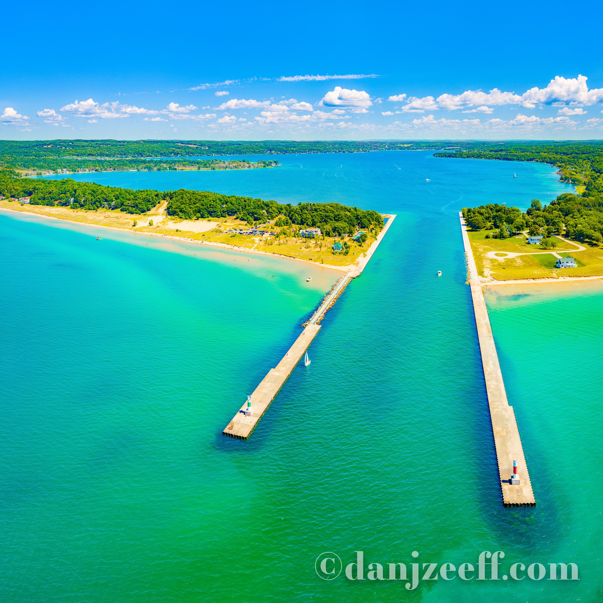
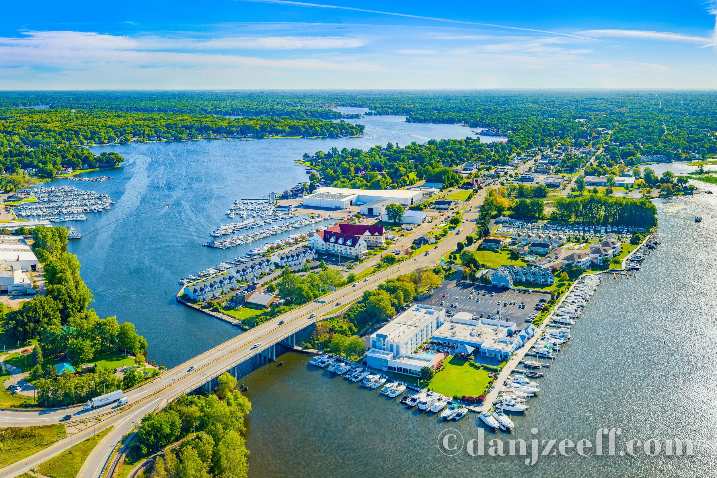
Portage Lake
Located near Onekama, Portage Lake is north of Manistee and South of Frankfort on the shores of Manistee County in Michigan's lower peninsula. This aerial photo was taken from the west looking towards the pier lights, with the town of Onekama in the distance.

Reeds Lake
Reeds Lake is located in East Grand Rapids, about 3 miles east of downtown Grand Rapids in Kent County in Michigan's lower peninsula. This aerial photo was taken northwest of the lake on a summer morning. In the foreground we have an overhead view of the boardwalks of Waterfront Park and off to the right are the grassy recreation areas of John Collins Park.

Reeds Lake
Reeds Lake is located in East Grand Rapids, about 3 miles east of downtown Grand Rapids in Michigan's lower peninsula. This aerial photo was taken southeast of the lake on a summer morning. In the background we can see the buildings of downtown Grand Rapids.

Rogers Dam Pond
Located near U.S. Highway 131 between Big Rapids and Stanwood, Rogers Dam is owned and operated by Consumers Energy. Rogers Dam, Hardy Dam and Croton Dam along the Muskegon River produce around 45,000 kilowatts of energy and power around 22,000 homes. This aerial photo was taken from SW of the dam on a summer day.
Silver Lake
Located between Rockford and Cannonsburg, Silver Lake is about 12 miles northeast of Grand Rapids in Michigan's lower peninsula. This aerial photo was taken north of the lake on a summer day.
Spring Lake
Located near Grand Haven in Michigan's lower peninsula, Spring Lake is connected to the Grand River and Lake Michigan. This aerial photo was taken southwest of the lake on a summer morning. This aerial photo is composed with the village of Spring Lake in the center, the Grand River on the right, and Spring Lake on the left.

Suttons Bay
Suttons Bay is located on the east side of the Leelanau Peninsula near the village of Suttons Bay, which is about a 16 mile drive north from Traverse City in Michigan's lower peninsula. This aerial photo was taken from southwest of the bay on a summer day.

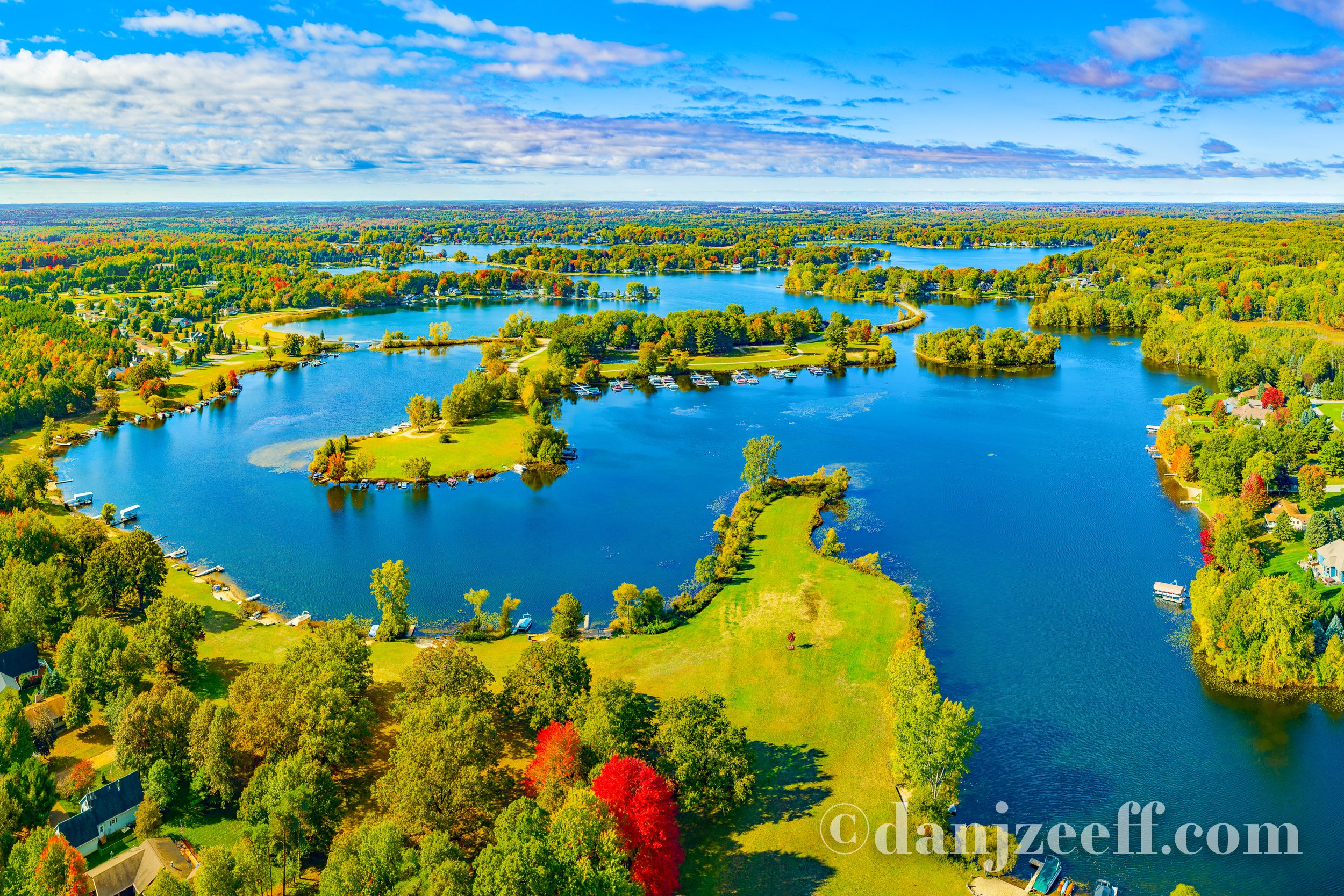
Sylvan Lake
Sylvan Lake is part of a chain of lakes near Newaygo, south of White Cloud and east of Fremont in Michigan's lower peninsula. This aerial photo was taken northeast of the lake on a summer day. Just beyond Sylvan lake is Emerald Lake, and then Pickerel & Kimball Lakes.

Torch Lake
Torch Lake is located near Bellaire, Central Lake, Alden, Rapid City, Eastport, Kewadin, Rapid City, and Elk Rapids, about 15 miles northeast of Traverse City in Michigan's lower peninsula. This aerial photo was taken north of the lake on a summer day. On the distant right is Grand Traverse Bay.

Torch Lake
Torch Lake is located near Bellaire, Central Lake, Alden, Rapid City, Eastport, Kewadin, Rapid City, and Elk Rapids, about 15 miles northeast of Traverse City in Michigan's lower peninsula. This aerial photo was taken southeast of the lake on a summer day.

Wall Lake
Wall Lake is located near Delton, between Kalamazoo and Hastings in Michigan's lower peninsula. This aerial photo was taken north of the lake on a summer day.
Walled Lake
Walled Lake is located near Novi, west of Farmington Hills and southwest of Pontiac in Michigan's lower peninsula. This aerial photo was taken southeast of the lake in the evening during peak fall foliage color. In the foreground is Pavilion Shore Park.

White Lake
White Lake is situated between Whitehall and Wabaningo, about 10 miles north of Muskegon on the western shores of Michigan's lower peninsula. Boaters have access to Lake Michigan through the channel between the White River Light Station Museum and Medbery Park on the left. This aerial photo was taken southwest of the lake on a summer day.

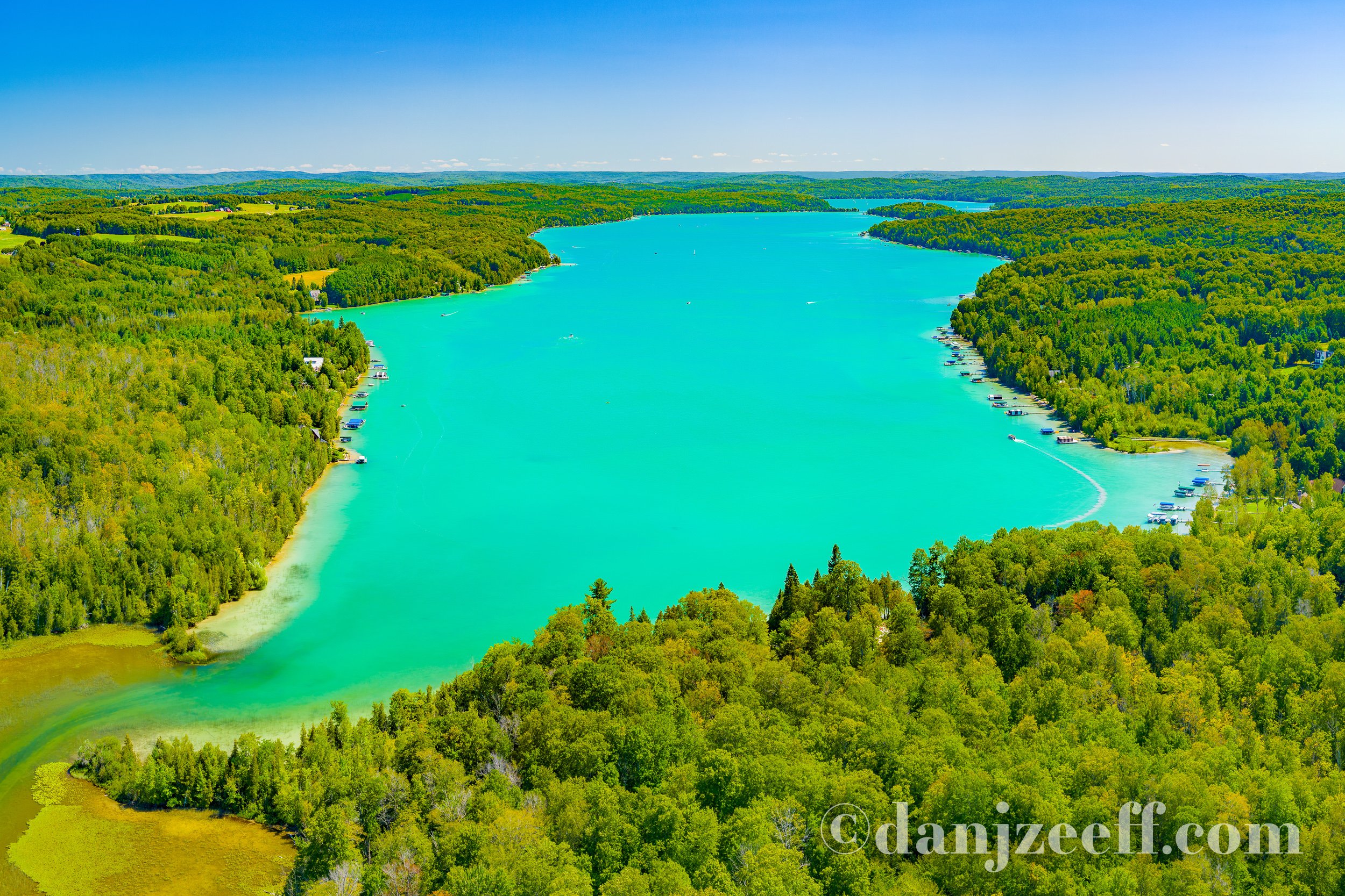
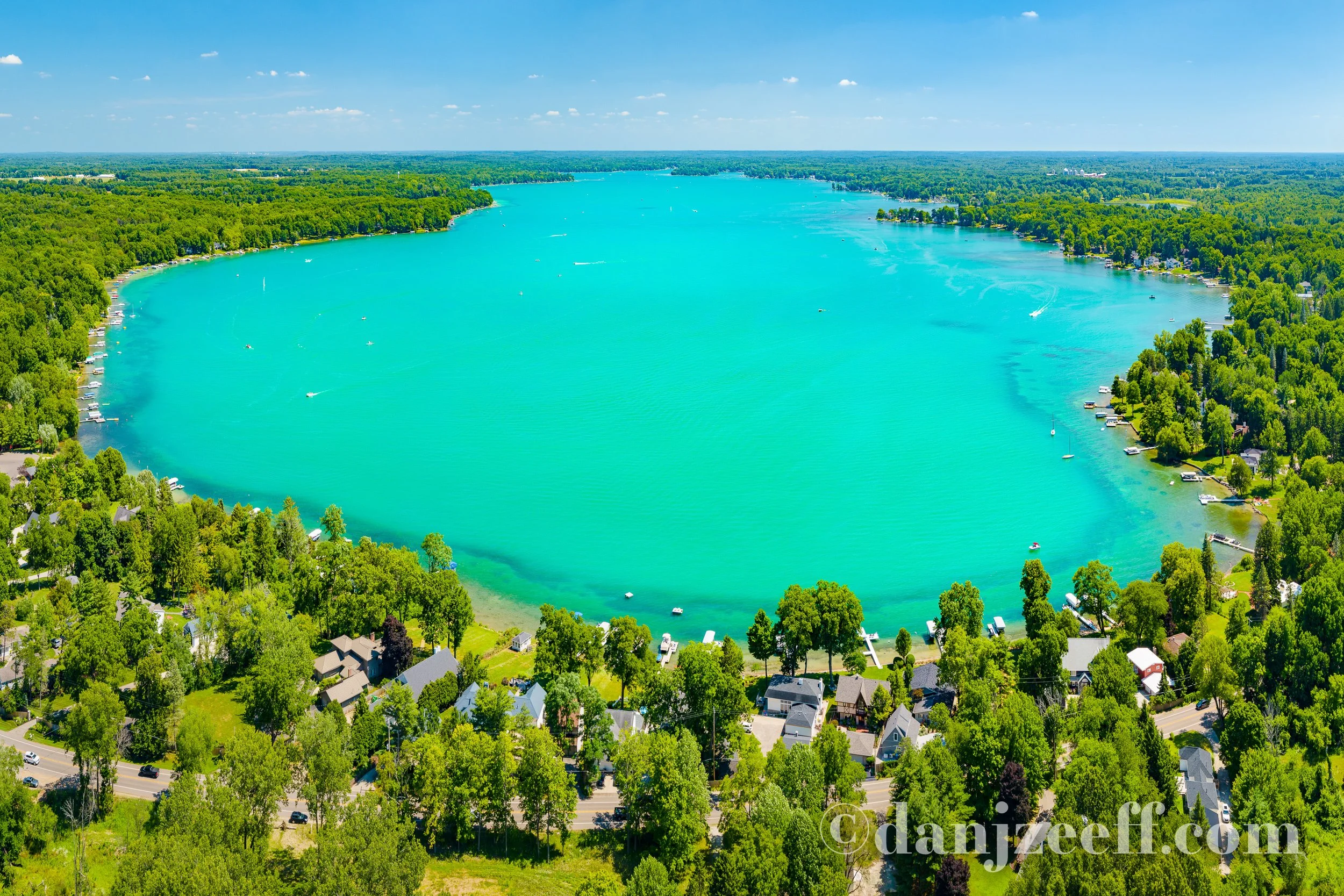
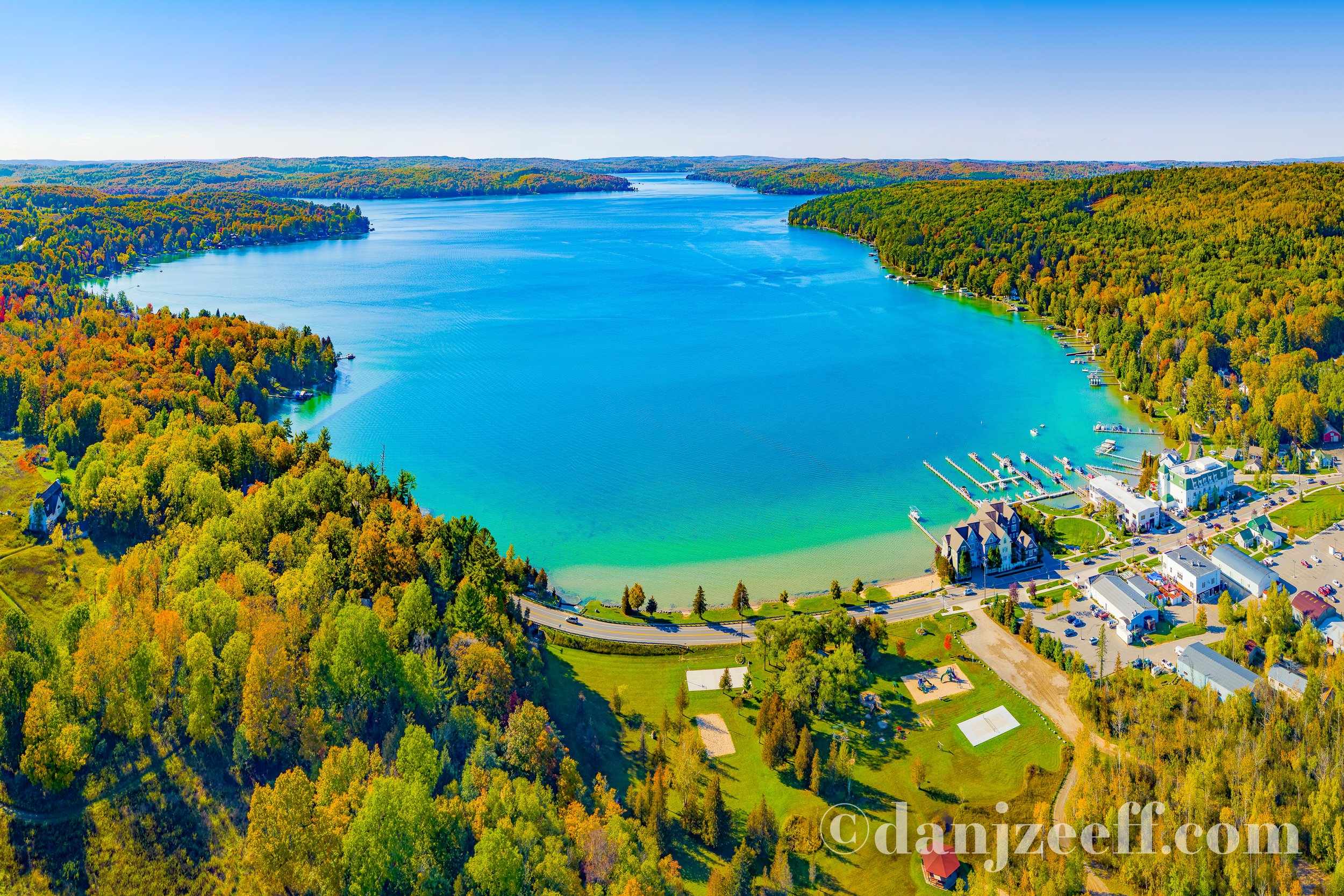
Walloon Lake
Situated between Boyne City and Petoskey, Walloon Lake is just northeast of Lake Charlevoix in Michigan's lower peninsula. This aerial photo was taken from the northwest end of the lake on a summer day. I had never seen Walloon Lake before, so I was amazed at how bright and vibrantly turquoise the water is when the summer sun hits the lake!
Walloon Lake
Situated between Boyne City and Petoskey, Walloon Lake is just northeast of Lake Charlevoix in Michigan's lower peninsula. This aerial photo was taken east of the lake on an evening in the early fall. In the foreground is Melrose Township Park.

Whitmore Lake
Whitmore Lake is situated between Brighton and Ann Arbor, near Webster, Worden, South Lyon, and the Township of Hamburg in Michigan's lower peninsula. This aerial photo was taken southwest of the lake in the morning during peak fall foliage color. In the foreground are the Harbor Cove Apartments and First United Methodist Church.
Lakes-of-Michigan.com Links

Complete Alphabetical Photo List
A
Allegan Dam near Allegan, Michigan - Aerial Photos
Arbutus Lake near Traverse City, Michigan - Aerial Photos
Austin Lake near Kalamazoo, Michigan - Aerial Photos
B
Baldwin Lake near Union, Michigan - Aerial Photos
Barlow Lake near Wayland, Michigan - Aerial Photos
Bear Lake near Muskegon, Michigan - Aerial Photos
Bear Lake near Onekama, Michigan - Aerial Photos
Berrien Springs Dam with Lake Chapin - Aerial Photos
Big Pine Island Lake near Belding, Michigan - Aerial Photos
Big Star Lake near Baldwin, Michigan- Aerial Photos
Birch Lake near Vandalia, Michigan - Aerial Photos
Black Lake near Cheboygan, Michigan - Aerial Photos
Blue Lake near Kalkaska, Michigan - Aerial Photos
Bostwick Lake near Rockford, Michigan - Aerial Photos
Bowers Harbor near Traverse City, Michigan - Aerial Photos
Brower Lake near Rockford, Michigan - Aerial Photos
Burt Lake near Indian River and Cheboygan, Michigan - Aerial Photos
C
Canadian Lakes near Big Rapids, Michigan - Aerial Photos
Cass Lake near Pontiac, Michigan - Aerial Photos
Cedar Lake near Traverse City, Michigan - Aerial Photos
Charlevoix, Michigan Area - Aerial Photos
Charlevoix Lighthouse Blue Hour Long Exposure with Boat Lights
Chippewa Lake near Big Rapids, Michigan - Aerial Photos
Croton Dam & Pond near Newaygo, Michigan - Aerial Photos
Crystal Lake near Benzonia & Frankfort, Michigan - Aerial Photos
Crystal Lake near Crystal, Michigan - Aerial Photos
D
Diamond Lake near Cassopolis, Michigan - Aerial Photos
Duck Lake near Interlochen, Michigan - Aerial Photos
Duncan Lake near Caledonia, Michigan - Aerial Photos
E
Elk Lake near Elk Rapids, Michigan - Aerial Photos
Empire Beach in Empire, Michigan - Aerial Photos
F
Fish Lake & Lime Lake near Delton, Michigan - Aerial Photos
Fisherman's Island State Park near Charlevoix, Michigan - Aerial Photos
Fishers Lake near Three Rivers, Michigan - Aerial Photos
Frankfort North Breakwater Lighthouse at Sunset
Frankfort and Elberta Area - Aerial Photos
Fort Michilimackinac and Mackinac Bridge - Aerial Photos
G
Glen Lake near Glen Arbor, Michigan - Aerial Photos
Grand Haven South Pier Lighthouses at Sunset
Grand Haven Lighthouses with Moon
Grand Haven Lighthouses with Boat Lights at Night
Grand Haven South Pier Lighthouses with Crashing Waves
Grand Traverse Bay near Traverse City - Aerial Photos
Grand Traverse Lighthouse - Aerial Photos
Green Lake near Caledonia, Michigan - Aerial Photos
Gull Lake near Kalamazoo, Michigan - Aerial Photos
Gun Lake near Wayland, Michigan - Aerial Photos
H
Hamlin Lake near Ludington, Michigan - Aerial Photos
Harbor Beach Lighthouse at Sunrise
Harbor Springs, Michigan - Aerial Photos
Hardy Dam Pond near Newaygo, Michigan - Aerial Photos
Higgins Lake near Roscommon, Michigan - Aerial Photos
Holland Big Red Lighthouse at Sunset
Houghton Lake near Roscommon, Michigan - Aerial Photos
I
J
K
Kalamazoo Lake near Saugatuck and Douglas - Aerial Photos
Klinger Lake near Sturgis, Michigan - Aerial Photos
L
Lake Angelus near Pontiac, Michigan - Aerial Photos
Lake Bella Vista near Rockford, Michigan - Aerial Photos
Lake Cadillac near Cadillac, Michigan - Aerial Photos
Lake Charlevoix near Boyne City and Charlevoix, Michigan - Aerial Photos
Lake Doster near Plainwell, Michigan - Aerial Photos
Lake Lansing near Lansing, Michigan - Aerial Photos
Lake Leelanau near Leland, Michigan - Aerial Photos
Lake Macatawa near Holland, Michigan - Aerial Photos
Lake Mecosta near Big Rapids, Michigan - Aerial Photos
Lake Missaukee near Lake City, Michigan - Aerial Photos
Lake Mitchell near Cadillac, Michigan - Aerial Photos
Lake Skegemog near Rapid City, Michigan - Aerial Photos
Leland, Michigan - Aerial Photos
Lime Lake near Glen Arbor, Michigan - Aerial Photos
Lincoln Lake near Gowen, Michigan - Aerial Photos
Little Sable Point Lighthouse with the Milky Way
Little Sable Point Lighthouse - Aerial Photos
Little Traverse Lake near Glen Arbor, Michigan - Aerial Photos
Long Lake near Belding, Michigan - Aerial Photos
Long Lake near Hastings, Michigan - Aerial Photos
Long Lake near Union, Michigan - Aerial Photos
Ludington, Michigan - Aerial Photos
Ludington North Breakwater Lighthouse with the Moon
Ludington North Breakwater Lighthouse at Sunset
Ludington North Breakwater Lighthouse in the Winter
M
Mackinac Bridge with Solar Eclipse
Mackinac Bridge - Aerial Photos
Mackinac Bridge at Sunrise and Sunset
Mackinac Island, Michigan - Aerial Photos
Mackinac Island at Night
Magician Lake near Dowagiac, Michigan - Aerial Photos
Manistee Lighthouse at Sunset
Manistee Lighthouse with the Moon
Maple Lake in Paw Paw, Michigan - Aerial Photos
Mission Point Lighthouse - Aerial Photos
Morrison Lake near Saranac, Michigan - Aerial Photos
Mullett Lake near Cheboygan, Michigan - Aerial Photos
Murray Lake near Lowell, Michigan - Aerial Photos
Muskegon Lake near Muskegon, Michigan - Aerial Photos
Muskegon Lighthouses at Sunset
Muskegon Lighthouses with the Moon
Myers Lake near Rockford, Michigan - Aerial Photos
N
Northport Bay by Northport, Michigan - Aerial Photos
O
Old Mackinac Point Lighthouse - Aerial Photos
Old Mission Harbor by Traverse City, Michigan - Aerial Photos
Omena Bay, Michigan - Aerial Photos
Orchard Lake near Pontiac, Michigan - Aerial Photos
Otsego Lake near Gaylord, Michigan - Aerial Photos
P
Palmer Lake near Colon, Michigan - Aerial Photos
Petoskey, Michigan Area - Aerial Photos
Pine Lake near Plainwell, Michigan - Aerial Photos
Pine Lake near Pontiac, Michigan - Aerial Photos
Point Betsie Lighthouse - Aerial Photos
Port Sanilac Lighthouse
Portage Lake near Onekama, Michigan - Aerial Photos
Pyramid Point Overlook at Sleeping Bear Dunes
Q
R
Reeds Lake in Grand Rapids, Michigan - Aerial Photos
Rogers Dam Pond near Big Rapids, Michigan - Aerial Photos
Round Island Lighthouse - Aerial Photos
S
Silver Lake in Rockford, Michigan - Aerial Photos
Silver Lake near Traverse City, Michigan - Aerial Photos
Sleeping Bear Bay by Glen Arbor, Michigan - Aerial Photos
South Haven, Michigan - Aerial Photos
South Haven Lighthouse at Sunset
South Haven Lighthouse with Moon
South Haven Lighthouse with Star Trails
Spider Lake by Traverse City, Michigan - Aerial Photos
Spring Lake and Grand Haven, Michigan - Aerial Photos
St Joseph Lighthouses at Sunset
St Joseph Lighthouses with Moon
St Joseph, Michigan - Aerial Photos
Sturgeon Lake in Colon, Michigan - Aerial Photos
Suttons Bay, Michigan - Aerial Photos
Sylvan Lake by Newaygo, Michigan - Aerial Photos
T
Thumb Lake near Boyne Falls, Michigan - Aerial Photos
Tippy Dam Pond near Wellston, Michigan - Aerial Photos
Torch Lake near Bellaire, Michigan - Aerial Photos
U
V
W
Wall Lake near Delton, Michigan - Aerial Photos
Walled Lake near Novi, Michigan - Aerial Photos
Walloon Lake near Petoskey, Michigan - Aerial Photos
White Lake near Whitehall, Michigan - Aerial Photos
Whitefish Lake near Cedar Springs, Michigan - Aerial Photos
Whitmore Lake near Ann Arbor, Michigan - Aerial Photos